Forth Anti-invasion defences – Methil-Balgonie line
| < Largo Bay | Δ Index | Kinghorn and its hinterland > |
Some 6km to the west, an east-facing defence line was drawn from just east of East Wemyss on the coast (NT 3431 9699), to a point on the River Leven, 4km to the NNW (NO 3262 0043).
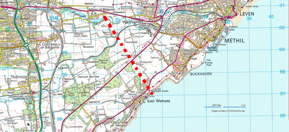
It comprised a discontinuous line of firing positions (about 1,700m long in total) fronted, for about 450m of its length, by barbed wire entanglements.
The wall around Balfour Mains farm was loop-holed.
One of the three War Department maps recording the defences seems to be missing from the file (the two on file are labelled ‘Markinch 1’ and ‘Markinch 3’); it is likely that further firing positions were marked on this missing sheet where the main road crossed the defence line
| < Largo Bay | Δ Index | Kinghorn and its hinterland > |